
Trace an Emporia Street
An address search should separate what a record proves from what it merely suggests. Lyon County parcel and deed records can identify an owner. They do not prove that the owner lives on the site. A voter record can confirm one registered person when the required details are known, but the public form does not return a block roster. A printed directory proves only that an entry appeared in that edition. Use the Emporia street directory method as a chain, and save the date and source at each link.
- Standardize the number, direction, street name, suffix, unit, city, and ZIP through USPS or Emporia GIS.
- Use the Lyon County Appraiser route and parcel map. Record the situs address, parcel ID, legal description, and stated owner.
- Inspect the same street segment in county or city GIS. Note adjacent parcels, road labels, additions, and plat names.
- Follow the owner and legal description into the Register of Deeds index. Match each transfer to the parcel before moving back.
- Confirm a known person through VoterView, then use a dated reverse or city directory for older occupants.
This order keeps a search by street tied to a real parcel. It also prevents a common mistake: treating a tax-mail address, a same-name voter result, or a directory line as proof of a full household.
Emporia Parcel Search Fields
The Lyon County Appraiser directs the public to Beacon, but that vendor page was blocked during research. A separate GSA form exposed detailed search controls, yet its city choices and footer were inconsistent with Kansas. Treat those controls as discovery aids, not as certified Lyon County data. Confirm a result with the Lyon County Appraiser or GIS staff before relying on it.
| Field | Input | Use by Address | Verification Need |
|---|---|---|---|
| Street number from/to | Number range | Limit one block or segment | Confirm returned situs values |
| Street name | Starts-with text | Browse parcels along one road | Test direction and suffix variants |
| City or subdivision | Multiple choice | Narrow Emporia or an addition | Portal geography was inconsistent |
| Parcel number | Contains or range | Bridge maps, tax, and deeds | Copy the exact county identifier |
| Seller, buyer, sale date | Text and date | Find a possible transfer | Match the deed and legal description |
| Tax district or use | Multiple choice | Sort a long street result | Do not infer who lives there |
The advanced parcel form shown below is useful chiefly as a field checklist. Its apparent county branding is not enough to establish that its results are sound for Emporia.
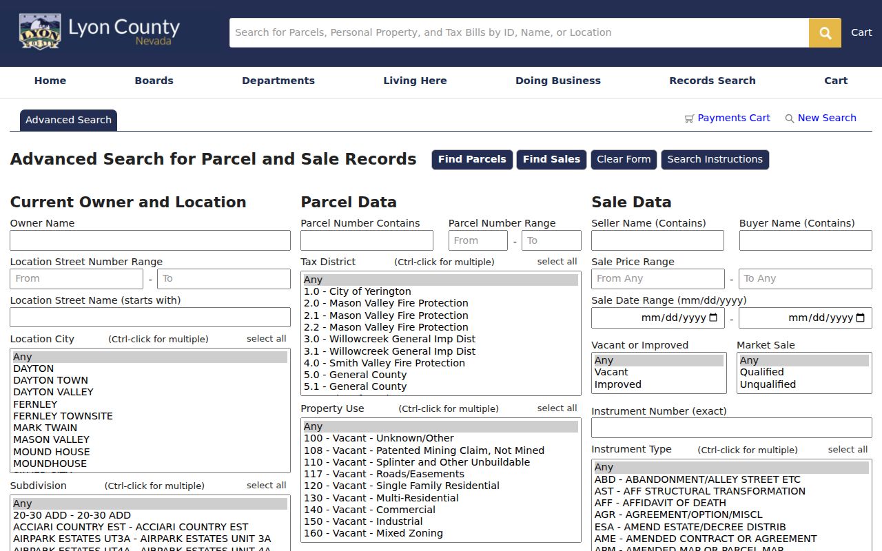
Use the street number, street name, subdivision, and parcel fields to frame a precise question for the Appraiser when the live portal cannot be trusted.
Map Emporia Streets and Parcels
Lyon County GIS maintains nearly 18,000 parcels and maps ownership, land use, roads, administrative boundaries, digital plats, and addresses. Emporia GIS adds zoning, city utilities, 911 address points, road centerlines, easements, survey ties, floodplain maps, and subdivision material. These layers help normalize an address and locate the correct parcel. The county warns that its digital data serves tax work and is not a legal survey or conveyance.
Locate the address, identify its polygon, and record the parcel and legal description. Click nearby polygons one at a time if the viewer permits it. Compare road labels and subdivision names. Do not infer a family tie merely because two lots touch. When map controls fail, GIS accepts data questions and requests through its published county channel.
City and county layers answer different parts of the same address question. County ownership and parcel polygons help establish the tract. Emporia's 911 points and road centerlines help settle the form of the street. Zoning and easement layers can explain why a parcel shape or access route looks odd, while a survey corner tie may help a technical plat question. Save the layer name and map date with any screen capture. If the result will support a deed or boundary claim, obtain the recorded plat or a proper survey rather than treating the web map as the final record.
- Parcel
- A mapped tract with its own county identifier and legal description.
- Situs address
- The physical location of land or a building, not the owner's tax-mail destination.
- Plat
- A recorded plan that lays out lots, blocks, streets, alleys, easements, and dedications.
- Criss-cross directory
- A dated directory section arranged by street and number instead of by surname.
Emporia Records Found by Street
No one record supplies a complete household list. The best Emporia street directory result comes from sources whose address keys overlap but whose claims differ. Online access is only one route. County and city counters, phone help, written records requests, library workstations, microfilm, and archive staff fill the gaps.
| Record Set | Keeper | What It Shows | Access |
|---|---|---|---|
| Parcel and tax record | Lyon County Appraiser | Owner, situs, mailing route, parcel, and values when shown | Beacon, phone, or office confirmation |
| GIS parcel map | Lyon County and Emporia GIS | Parcels, roads, addresses, plats, zoning, and boundaries | Online maps or a GIS data request |
| Deeds and plats | Lyon County Register of Deeds | Recorded owners, transfers, legal descriptions, and instruments | Laredo/Tapestry or courthouse records |
| Voter record | Kansas SOS and Lyon County Elections | One known registrant and polling context | VoterView or supervised list access |
| Planning and permits | Emporia Planning or City Clerk | Address, applicant, owner, legal description, and project record | Forms online; defined KORA request for files |
| Historical directory | KSHS, EPL, and local archives | Dated resident or business entries, sometimes in street order | Database, microfilm, ILL, or staff request |
The parcel ID and legal description are the strongest links between maps, plats, tax records, and deeds. A street string helps with permits and old directories, but its spelling can shift. Keep both forms in the working notes.
Access also changes with the task. A quick parcel check may work online. An older deed can require a courthouse book or staff search. A permit file may call for a defined city KORA request, while a directory reel may come through interlibrary loan. State the address, record type, and date range when asking for help. That narrow request gives the custodian a far better chance of finding the right item.
Deeds Along an Emporia Block
The Register of Deeds records-search page sends researchers to Fidlar's Laredo and Tapestry services. Begin with a current parcel and legal description. Find its present grantee, copy the deed reference, then search the named grantor as an earlier grantee. Repeat only after the legal description shows that each hit concerns the same land.
The county page does not publish the online index cutoff or the vendor's exact result fields. When the online trail ends, call or visit the Register of Deeds at 430 Commercial Street and ask whether the older instrument is in an office index, deed book, microfilm, or another archive. Copies, certified records, and searches can carry fees under the county schedule.
The official handoff pictured below shows why a street search may leave the county site for an account-based service.
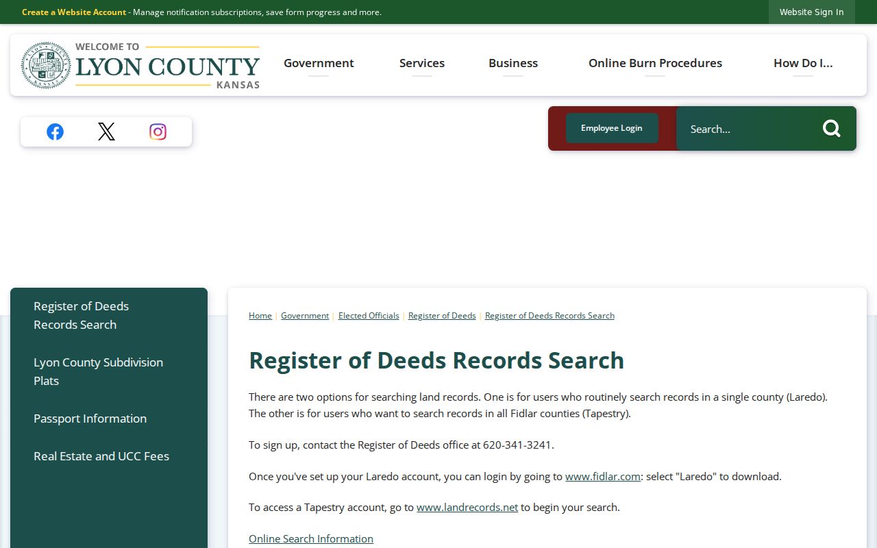
Record the vendor used, search date, instrument reference, and office response so a deed chain remains auditable.
Emporia Plats Fix Address Gaps
Street names are often weaker than a recorded lot and block. The Lyon County subdivision plat collection is arranged by named additions and includes the Emporia Original Townsite. It can bridge a downtown parcel to a legal description and show dedicated streets, alleys, easements, and neighboring lots.
The plat collection is especially helpful around the original city center at 6th and Commercial. Emporia's downtown historic district covers about 18 blocks and 169 buildings, so one modern address can lead to a plat, historic nomination, Sanborn sheet, deed, and directory entry. The plat page below supplies the starting index, while the recorded document controls any legal conclusion.
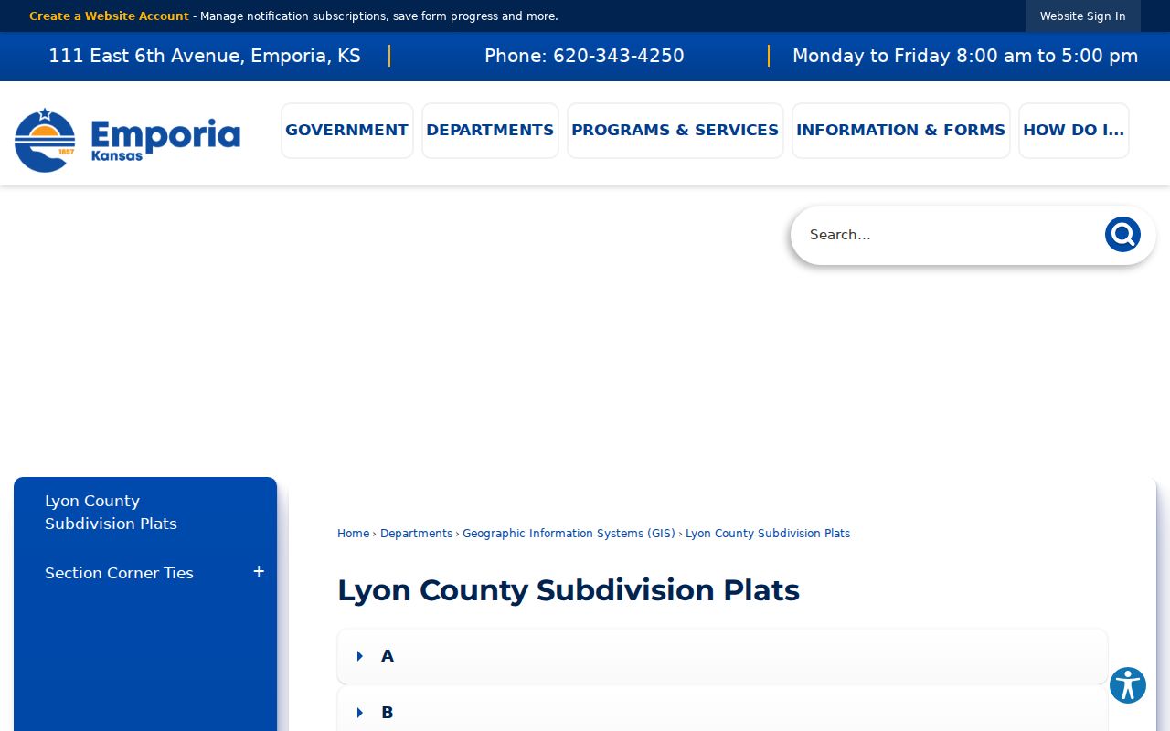
Save the addition, block, lot, and street labels before searching a deed service or asking GIS to reconcile an old address.
Check Emporia Tax Address Clues
A tax search can connect an account to a parcel, year, and mailing route, but the page must be read with care. The owner's mailing address may be a post-office box, another Emporia location, another Kansas city, or an out-of-state destination. It is not proof that the owner lives at the situs address.
The Lyon County tax search was captured for this street-directory assignment, though the wider GSA environment showed data-quality concerns. Use it as a route to a dated account clue, then verify the parcel and owner with the county office.
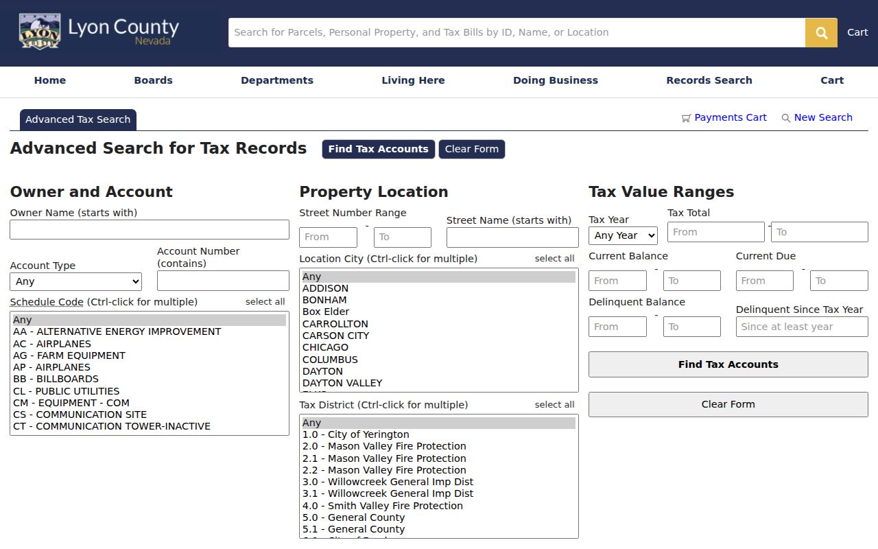
The distinction between tax mail and physical location keeps an ownership search from becoming an unsupported residence claim.
Emporia Voters and Permit Files
Kansas VoterView asks for first name, last name, and date of birth when checking a registrant. Its address field is aimed at polling-place lookup, not a list of all people along a road. Kansas law also permits supervised inspection and written copies of active registration lists with protected identifiers removed, while concealed addresses and Safe at Home records stay protected.
For property work, Emporia planning forms may hold a site address, legal description, applicant, owner, project details, or nearby-owner notice context. No complete public permit or code-case index was located. Submit a narrow city records request by address, permit number, project, and date range. The City Clerk's KORA route and departmental phone help are the fallback channels.
Note: A voter result can support one known identity, but it should never be turned into an assumed street roster.
Older Emporia Streets by Year
For past occupants, ask whether a specific Emporia edition has a reverse or criss-cross section. Verified directory years include 1883, 1887–88, 1890–91, and Polk's county-inclusive 1938–39 volume. Intermittent microfilm leads reach through 1960, but missing years and the presence of reverse sections must be checked edition by edition.
KSHS Sanborn sheets add building and street context for 1884, 1888, 1893, 1899, 1905, 1911, 1923, 1929, 1929–46, and 1962. They do not name occupants. Pair the closest map date with a directory, census, deed, and newspaper. The historical shelf is treated in depth on the Emporia city directory page.
No official source located a citywide street-renaming or renumbering year. Emporia's piecemeal annexation and its mix of numbered avenues, named streets, directionals, rural road numbers, and additions make variants worth testing, but none should be stated as fact without GIS or Planning confirmation.
Limits of Emporia Street Records
An Emporia street directory assembled from public records cannot show every person who sleeps, receives mail, or spends time at an address. Owners may live elsewhere. Renters and other household members may never appear in property records. Utility customer accounts and protected addresses are not a public shortcut. A map proves location, not kinship. A deed proves a recorded transfer, not today's occupancy.
Use dated, lawful records for family history, deed research, estate work, civic inquiry, or personal safety. Verify sensitive facts with the custodian and, when apt, the person concerned. Do not publish a protected location or press past a clear safety limit.
Lawful use. Emporia address records support lawful personal research. Never use a street search to stalk, harass, intimidate, or expose a protected person.